 GeoJSONic
Virtual journey · Australia / Chile / Argentina
Across the Pacific to the Andes
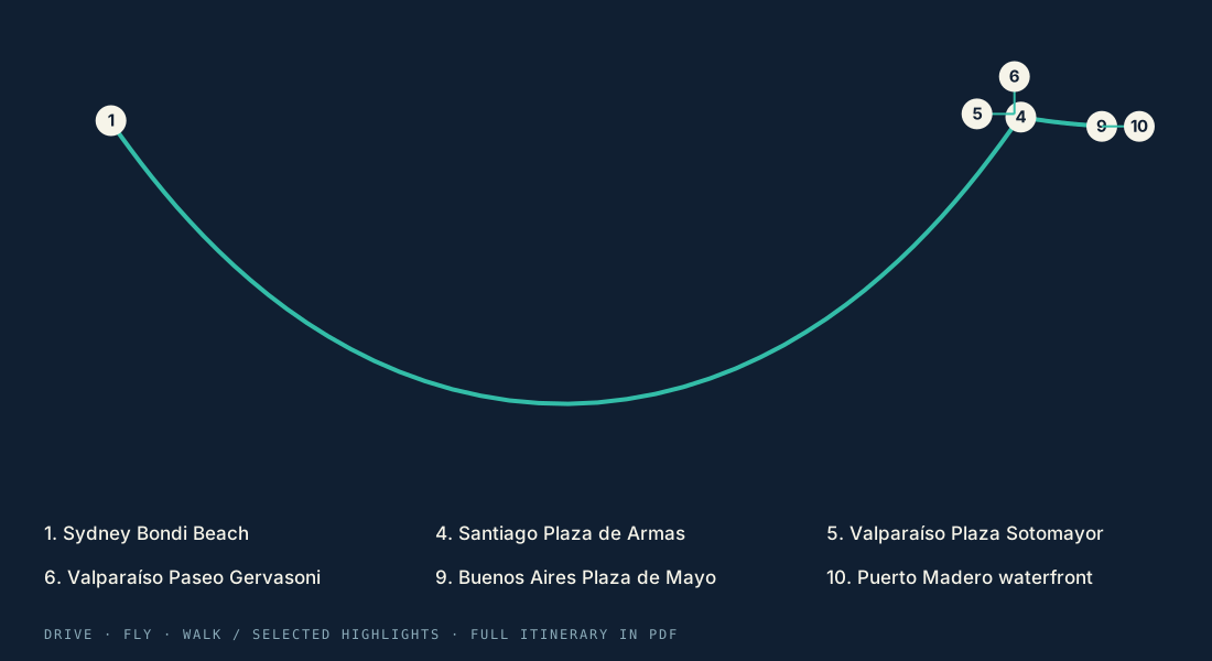
Cross the Pacific, explore Santiago and Valparaíso by road and on foot, then fly to Buenos Aires for a final city walk.
Opening the map…
The stops are ordered for driving, walking or cycling legs as labeled; GeoJSONic generates the ground route on your device. Flights are illustrative airport-to-airport arcs, not booked flights or airline tracks; connections may be required. Travel estimates exclude visits and airport procedures. The route is generated on your device when you open the trip; the line here is an illustrative preview. Travel times are rough estimates and exclude stops, airport and port procedures, and layovers.
Sydney Bondi Beach → Puerto Madero waterfront
10 stops. Your pace.
No fixed travel dates. Follow the full itinerary or use it as your starting point.
- 01
Sydney Bondi Beach
Start here - 02
SYD airport terminal
Drive to this stop - 03
SCL airport terminal
Fly to this stop - 04
Santiago Plaza de Armas
Drive to this stop - 05
Valparaíso Plaza Sotomayor
Drive to this stop - 06
Valparaíso Paseo Gervasoni
Walk to this stop - 07
SCL airport terminal
Drive to this stop - 08
AEP airport terminal
Fly to this stop - 09
Buenos Aires Plaza de Mayo
Drive to this stop - 10
Puerto Madero waterfront
Walk to this stop
- Open the tripWith the latest 1.3 build installed, tap “Open this trip in GeoJSONic,” or scan its QR code inside the app.
- Land on the globeYour trip loads and saves inside GeoJSONic. No Files app or Share sheet needed.
- Preview the first legExplore the route and make the journey yours. Scan again to reopen your saved trip.
Explore the region
Local tourism information to help make this itinerary your own.